Important Contact Information Change

In accordance with the new Covid-19 Mandates issued by the governor, please be aware our office will be closed until December 13th. Phone calls to the office may not be answered in a timely manner!

In the meantime if you need to speak with us, please instead call 502-592-2355 to get in touch with Anne Bader. You may also email her at abader@ciarch.com. We are still dedicated and moving forward with current projects working from home and continuing with field work.

Thank you for your patience!

HMB Acquires Corn Island

“We are excited to announce that as of December 1rst, 2023 Corn Island has joined HMB Professional Engineers. As Corn Island Archaeology transitions to its new role as a part of HMB, I want to express my deepest gratitude and appreciation of all our great clients, both recent ones and those with whom we have worked throughout the last 17 years. We have collaborated on some terrific projects, supported our communities, and given back to the public. We have made friends in these business relationships and I hope that we can continue to work together in the future as HMB. We will still be here in Jeffersontown, in our beloved 200-year old residence on Watterson Trail. Drop by anytime! Thank you all so much. Looking forward to the next great project.”
-Anne

Read Full Press Release

Poor Farms Cemetery Memorial

Late September, we gathered in Clark Couny Indiana for the memorial service and formal dedication of the recently relocated Clark County Poor Farm Cemetery. Corn Island was honored to be trusted by River Ridge with the archaeological disinterment of 33 individuals buried at the Poor Farm from 1930-1939. Corn Island’s Mindi Wetzel was the PI on this project.

Learn more about the cemetery and the work Corn Island did to preserve and relocate it here: ‘Poor Farm Cemetery’ relocation, preservation work completed at River Ridge

Technology Meets Archaeology

Corn Island archaeologists utilize photogrammetry, a technique for calculating the relationship
between multiple overlapping photographs to derive precise 3D measurements. For
archaeologists, photogrammetry is a useful tool for measuring any number of items from small
handheld artifacts to entire archaeological sites.
Photogrammetry is a type of remote sensing technique and is just one of several methods for
detecting and deriving information from afar. Remote sensing can assist in measuring difficult
to access features, including those below ground, or tall objects in the field that otherwise
cannot be safely accessed. With the availability of today’s digital cameras and unmanned aerial
systems platforms, modern photogrammetry equipment is more accessible making survey
easier and more flexible than in the past. In fact, remote sensing techniques have been in use
for over a century dating back to the practice of attaching cameras to balloons for aerial
observation during the U.S. Civil War. The earliest uses of photogrammetry came shortly after
in the early 20 th century when aerial photographs were collected and viewed in stereo pairs to
interpret relief aiding in the development of topographic maps.
Aside from deriving precise measurements, photogrammetry is increasingly used from digital
curation of individual artifacts to aiding in high-resolution site interpretation in GIS software.
Fragile artifacts can be shared digitally as a 3D model presenting a more tangible sense of the
item’s attributes and geometry when compared to standard photographs. Historic structures
that are in disrepair or slated for modification can be recorded in situ to fully document
integrity and complex site context. Spatially referenced images of landscapes can be
orthorectified in photogrammetry software when collected using ground control points (GCPs)
and utilized as datasets in GIS providing a basis for additional analysis. 3D point clouds and
polygonal mesh models are common products derived from photogrammetric model
development.
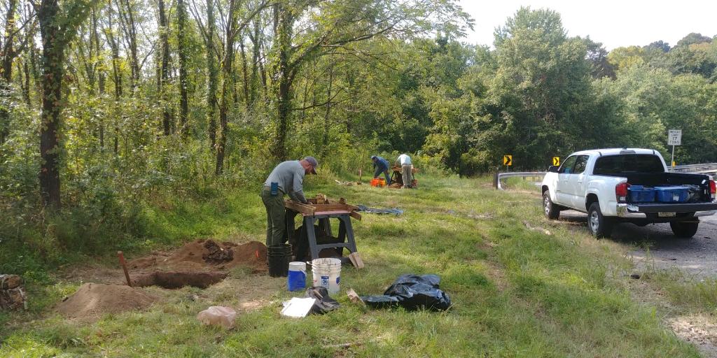
Corn Island recently used photogrammetry to document and measure a historic bridge
abutment in Spencer County, KY.

Coronavirus News

The offices of Corn Island Archaeology LLC are closed indefinitely during the current pandemic crisis. Our staff are working remotely from their homes. If you need to reach us, please do not call or leave a message at our office number. You can email Anne Bader at abader@ciarch.com or call her at (502) 592-2355. You can likewise call or email the project manager that you are currently working with. Don’t hesitate to reach out if there is a need. We will be checking our email regularly. We are continuously evaluating the appropriate level of social distancing in relation to fieldwork and travel to be sure we are following the latest guidance. We are doing our best to keep everyone’s projects moving forward in this difficult time.

KAS teams up with Bridging Kentucky

Corn Island Archaeology and the Kentucky Archaeological Survey (KAS) from Western Kentucky University have teamed up to evaluate an archaeological site in southern Kentucky. This site is located in the project area of a proposed bridge reconstruction project in the statewide Bridging Kentucky Project. Materials from various cultural periods are being revealed at this site.

Bridging Kentucky

We’ve been to some very interesting places all across the state thanks to the Bridging Kentucky! Started by the Kentucky Transportation Department, this initiative aims to rehabilitate, repair, or replace more than 1,000 bridges across the state. We’ve been doing our part as one of the teams assessing many of these structures. The following are a few that we’ve reviewed recently in District 5.

Louisville Magazine & Metro TV

Beecher Terrace project featured in this month’s Louisville Magazine. Tossed and Found covers some of the history and artifacts that we’ve uncovered at the ongoing Beecher Terrace site in downtown Louisville. Read the Full article here.

Our archaeologists and staff were also interviewed for Louisville Metro TV recently, also on the Beecher Terrance site. Watch the Story Here.

Riverport Public Display

Corn Island has recently finished preparing a educational display for Riverport. We gathered early artifacts and researched residents to give an informative look at the life of early settlers from the area. This display is currently available for viewing at select locations on a rotating basis. Please see the schedule below to find out more.

  • August 1-31, 2018: SW Regional Library
  • March-April, 2018: FairdaleLibrary
  • July 20, 2018: Bernheim Forest: Celebration of the Ancient Past
  • August 16- September 30, 2018: South Central Regional Library
  • October 1-31, 2018: Jefferson Memorial Forest
  • March 1-31, 2019: Bon Air Library